|

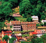
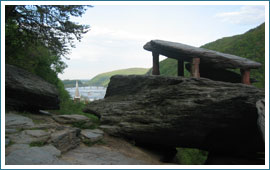
Jefferson Rock is comprised of several large masses of the sedimentary rock known as Harpers shale piled one upon the other. Located within the boundaries of Harpers Ferry National Historical Park, it is accessed today by a somewhat steep climb up old stone stairs just above St. Peter’s Church. The rock was fortified with four stone pillars in the late 19th century. The natural view from the rock today is the same as it was when Thomas Jefferson stood upon this spot on October 25, 1783—the confluence of the Shenandoah and Potomac rivers and the cut they make in the first line of the Blue Ridge Mountains. The mouth of a railroad tunnel and restored town are manmade additions. “The passage of the Potowmac through the Blue Ridge is perhaps one of the most stupendous scenes in nature. You stand on a very high point of land. On your right comes up the Shenandoah having ranged along the foot of the mountain a hundred miles to seek a vent. On your left approaches the Potowmac, in search of a passage also. In the moment of their junction, they rush together against the mountain, rend it asunder and pass it off to the sea . . . This scene hurries our senses into the opinion that in this place . . . the rivers have been dammed up by the Blue Ridge . . . and have formed an ocean which filled the whole valley . . . This scene is worth a voyage across the Atlantic . . . to survey these monuments of a war between rivers and mountains which must have shaken the earth itself to its center...”
Thomas Jefferson, Notes on the State of Virginia – 1785.
|
 |
||||||||||||||
Copyright © 2010, Washington Heritage Trail, Inc. Funded in part by the Federal Highway Administration.


